
Ups-and-downs before cold settles back in at the end of the year
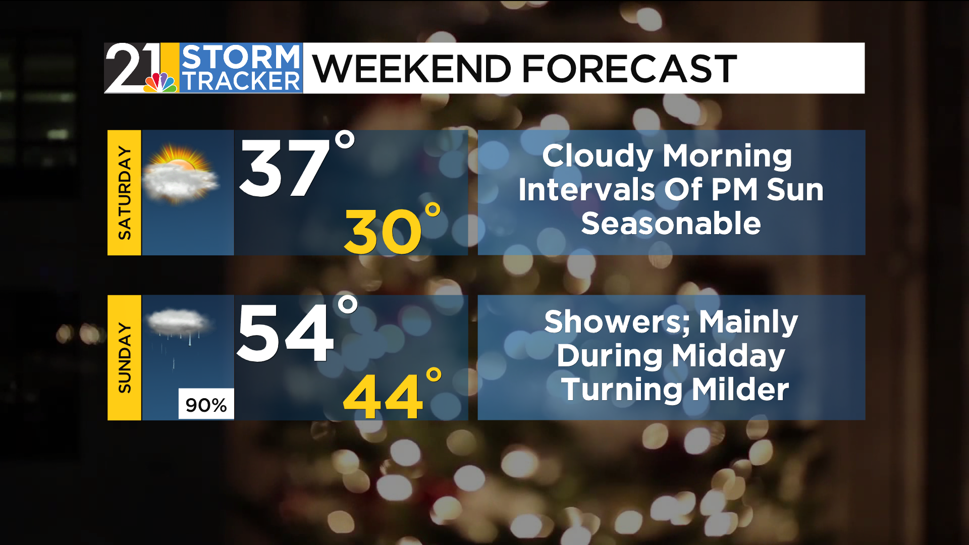
The cold rain that plagued much of the region on Friday will not return for the start of the weekend. Saturday will shape up to be an uneventful day with plenty of morning clouds followed by some intervals of afternoon sun. Temperatures will be near the seasonal average in the afternoon.
Low pressure will gather strength as it comes east during the weekend. A fairly strong push of mild air will precede the storm system, and temperatures will spend several hours in the 50s late Sunday afternoon into Sunday night. The warm front associated with the system will bring a good chance for showers during the midday hours. A break from the wet weather is likely to unfold later in the afternoon and into the evening. Meanwhile, a potent cold front should spark showers and thunderstorms across the lower Ohio Valley Sunday afternoon and evening; these raindrops should push into our area later at night.
The cold front is expected to cross eastern Ohio and western Pennsylvania around daybreak Monday. Temperatures will fall sharply throughout the day, and the gusty wind will create wind chill values in the teens during the afternoon. While there can be some flurries around Monday afternoon, more impactful snow showers are a good bet Monday night. It will be quite cold during the last couple of days of 2025 and at the start of the new year.

