Cold and cloudy Wednesday and Thursday, then snow returns Friday

Some clearing of the sky overnight will make for a cold start to the day Wednesday. Temperatures won't be far from the zero-degree mark in many locations, but at least the wind will be mainly calm. Wednesday afternoon looks mostly cloudy with temperatures falling well short of the seasonal average once again. Thursday will play out in a similar fashion, although daybreak readings won't be as low as Wednesday's.
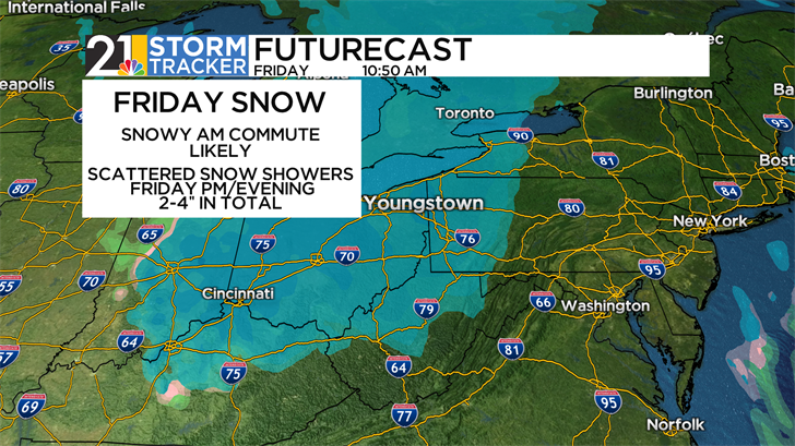
An "Alberta Clipper" system is likely to impact most of the Great Lakes region Thursday night into Friday. Locally, we expect snow to move in toward daybreak and the morning commute can feature some slick surfaces. Snow should become more scattered in nature during the afternoon and evening, but any snow shower could bring impactful snow rates for a time. All told, snow is likely to accumulate 2-4 inches between daybreak Friday and Friday evening. Spotty snow flurries will remain a possibility into Saturday morning.
The first full weekend of February will also start on a bitterly cold note. Wind chill values will remain below zero all day Saturday, with air temperatures no higher than 10 above. Sunday also looks cold, but with less wind.
February's first above-freezing temperatures are set to arrive by the middle of next week.