A mild stretch of weather Tuesday-Friday, then a colder weekend

Fog gave way to clouds and some sunshine on Monday, and afternoon temperatures climbed into the 40s. A more significant temperature jump is on the way Tuesday, which will start on a balmy stretch that will take us through the end of the work week. Some patches of fog will be a possibility Tuesday morning, although it is unlikely to be as widespread as early Monday. The afternoon looks partly sunny with reading sin the 50s.
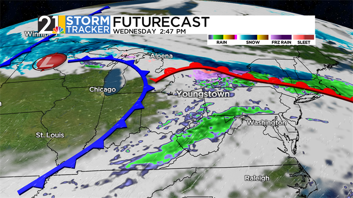
A warm front is on track to push into eastern Ohio and western Pennsylvania late Tuesday night into the first half of Wednesday; rain showers will come and go during that time. While the bulk of the afternoon will be brighter and drier, a passing shower or even a thunderstorm can't be ruled out.
After a mild and pleasant Thursday, unsettled weather is back in the forecast for Friday. The majority of the raindrops sho9uld fall before lunchtime and some afternoon sun will help send temperatures back into the mid 50s. Colder air will follow for the weekend. Some snow or flurries will be a possibility by Sunday.