
More light snow Monday, tracking two fast-moving systems midweek

While most of us woke up to a bit of snow on the ground, that has largely melted as of Sunday evening.
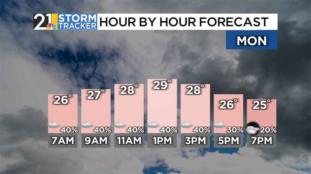
More snow is expected to accumulate as an upper-level disturbance continues to produce snow throughout the rest of the night. By tomorrow, the pattern will shift to a more lake-enhanced look, primarily affecting those closer to Lake Erie – specifically, those in northern Trumbull and northern Mercer counties. High temperatures will still be low, around 30 degrees. Between Sunday evening and Monday night, most of us should deal with another coating, though folks in extreme northern Trumbull and Mercer counties could get up to a few more inches of accumulation. Those flurries should finally subside overnight into Tuesday.
After the snow comes to a close, we’ll remain cold on Tuesday. High temperatures will similarly be close to 30 degrees, though it won’t be as breezy. We’ll get a few breaks of sun close to midday, though clouds will quickly fill in later on. Temperatures will increase overnight, along with the chance of some snowflakes.
These snowflakes will come from a quick-moving clipper system, mainly late in the evening and overnight. Some more flurries could spill into Wednesday, though the day will be mainly dry. Partly to mostly cloudy skies will rule the middle of the week with temperatures milder, around 40°.
Another weathermaker is set to roll around the valley on Thursday. The specifics of this still need to be ironed out, but we think precipitation will move in early on Thursday, with a mix of rain and snow likely during the day. High temperatures will be in the mid to upper 30s.
After Thursday’s rain and snow, we’ll deal with drier conditions to open up the weekend. Friday looks to be a mainly sunny day, with Saturday following the same script. The first half of the weekend will be mild, with temperatures close to 50°, though we’re expecting temperatures to fall back down below average once the weekend is set and done.
