Increasingly May-like weather through the weekend

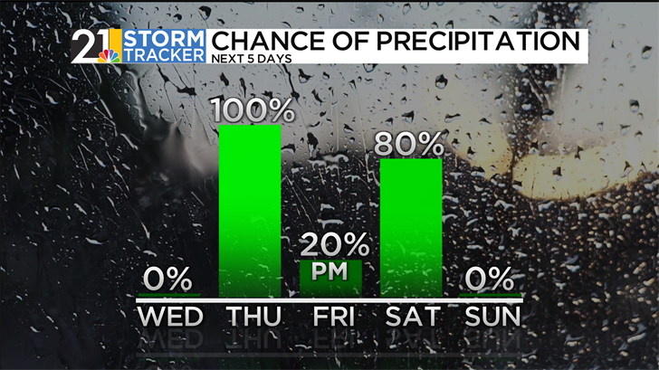
The Valley was dampened by a few bouts of rain on Tuesday, but temperatures ended up in the relatively mild mid 40s. However, that will be the coolest afternoon we have for at least a week! Highs Wednesday will be in the 50s areawide. Watch for areas od dense fog as the day gets underway, but the afternoon looks dry with some intervals of sun. We expect rain showers to return Wednesday night into Thursday.
Another wet period Thursday will be followed by another quieter interlude on Friday. While an afternoon shower can't be ruled out, much of the day will be rain-free with the warmest afternoon temperatures of 2026 so far. Saturday looks even more May-like with record-challenging warmth. Meanwhile, a cold front will slice into the balmy air mass and the result will be a good chance for showers and thunderstorms Saturday afternoon. Some storms could be on the strong side.
In the wake of the front, a quieter day is in the forecast for Sunday. It will still be quite mild for early March, just not as warm as Saturday. The unseasonably warm air will stick around into the first half of next week.