Weather
Weather 101: A mid-season look back at the Tropical Atlantic
This year's tropical season is riding a much milder path off of 2024's destructive coattails. Find out why here.
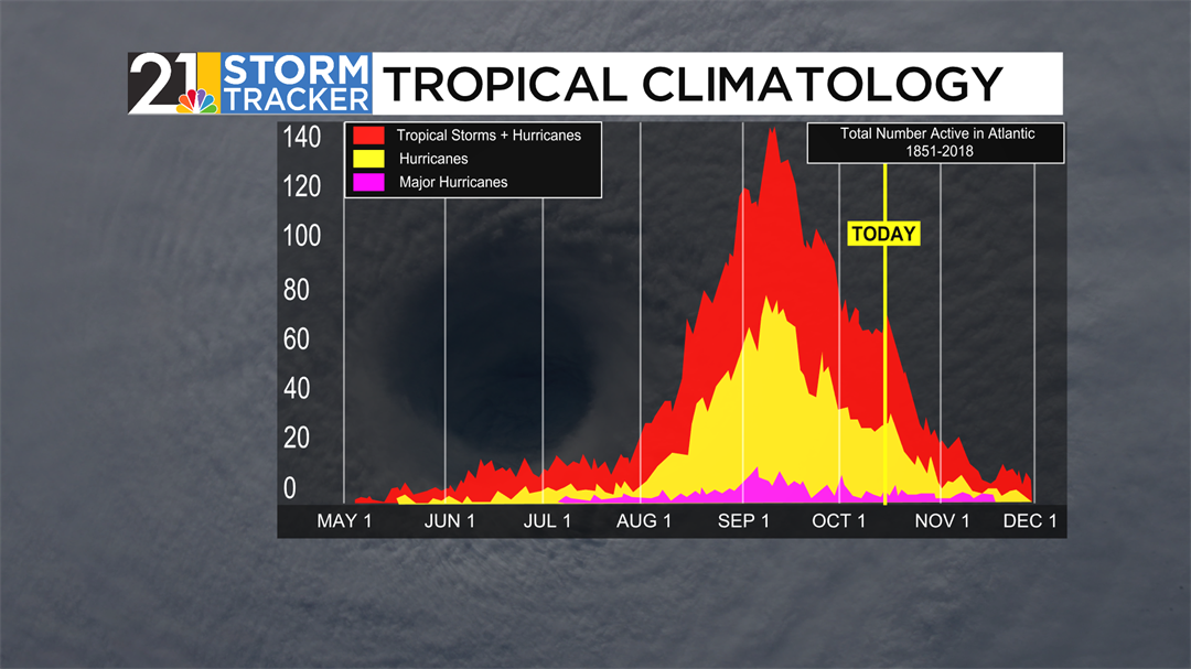
While the middle of October is regarded as a cool, dry month compared to the fading summer months, this time of year is still considered an active one in the Atlantic Ocean.
The September 10th peak of the Atlantic hurricane season has come and gone, and with just over a month and a half to go in the “official” season, it calls for a deeper dive into how 2025 has played out compared to average.
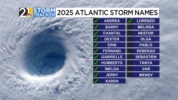
Since late June, thirteen named systems have developed in the Atlantic Ocean. Currently, Lorenzo is the only active named storm, churning East of the African coast as of Monday afternoon. Before Lorenzo, this year’s storms have been a part of an interesting trend: either sputtering off into weak, short-lived tropical storms or booming into long-lived major hurricanes.
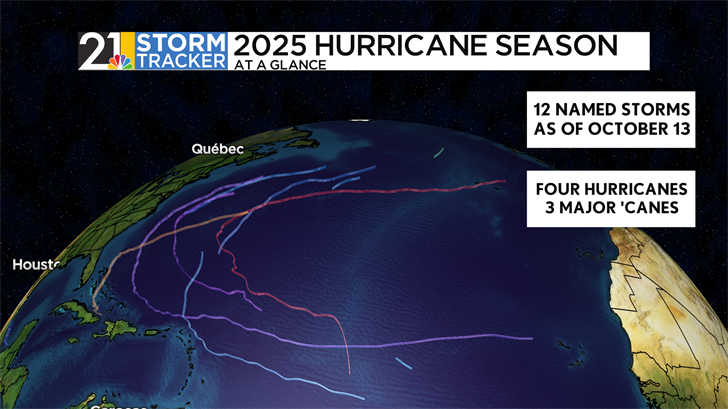
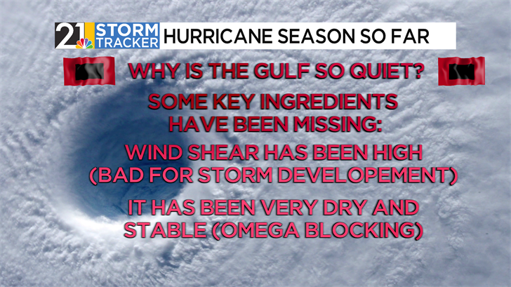
Three storms, Erin, Gabrielle, and Humberto, have developed into major hurricanes since the season started. Erin and Humberto, both eventual category 5 hurricanes, took similar tracks, starting in the open Atlantic and curving North of Bermuda. In fact, this path has been the dominant look for all four hurricanes that have formed this season, thanks to a dominant omega blocking pattern that has allowed much of the Eastern third of the country to be dry over the last two months.
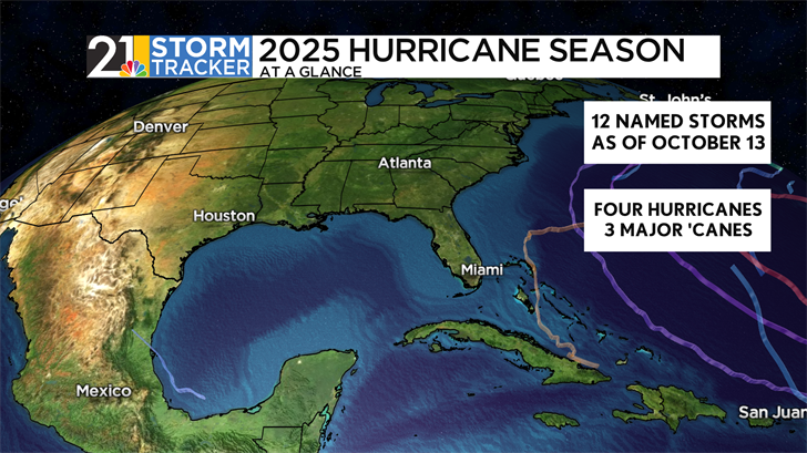
This pattern has allowed for a shocking lack of activity in the Gulf, typically a hotbed for storm formation. So far, only one storm, Barry, has even occupied the body of water. This was the same place responsible for the rapid development of now-retired hurricanes Beryl, Helene, and Milton last year.
Compared to norms, though, the season has otherwise followed typical climatological norms. The twelve named storms that have formed are almost exactly average (12.2 as of October 13th). On average, this season has been less popularized due to the lack of direct hurricane landfalls.
Tropical Storm Chantal was the only named storm to make landfall in the United States earlier in July. If this holds, this would be the first time that an active hurricane has not made landfall in the United States.
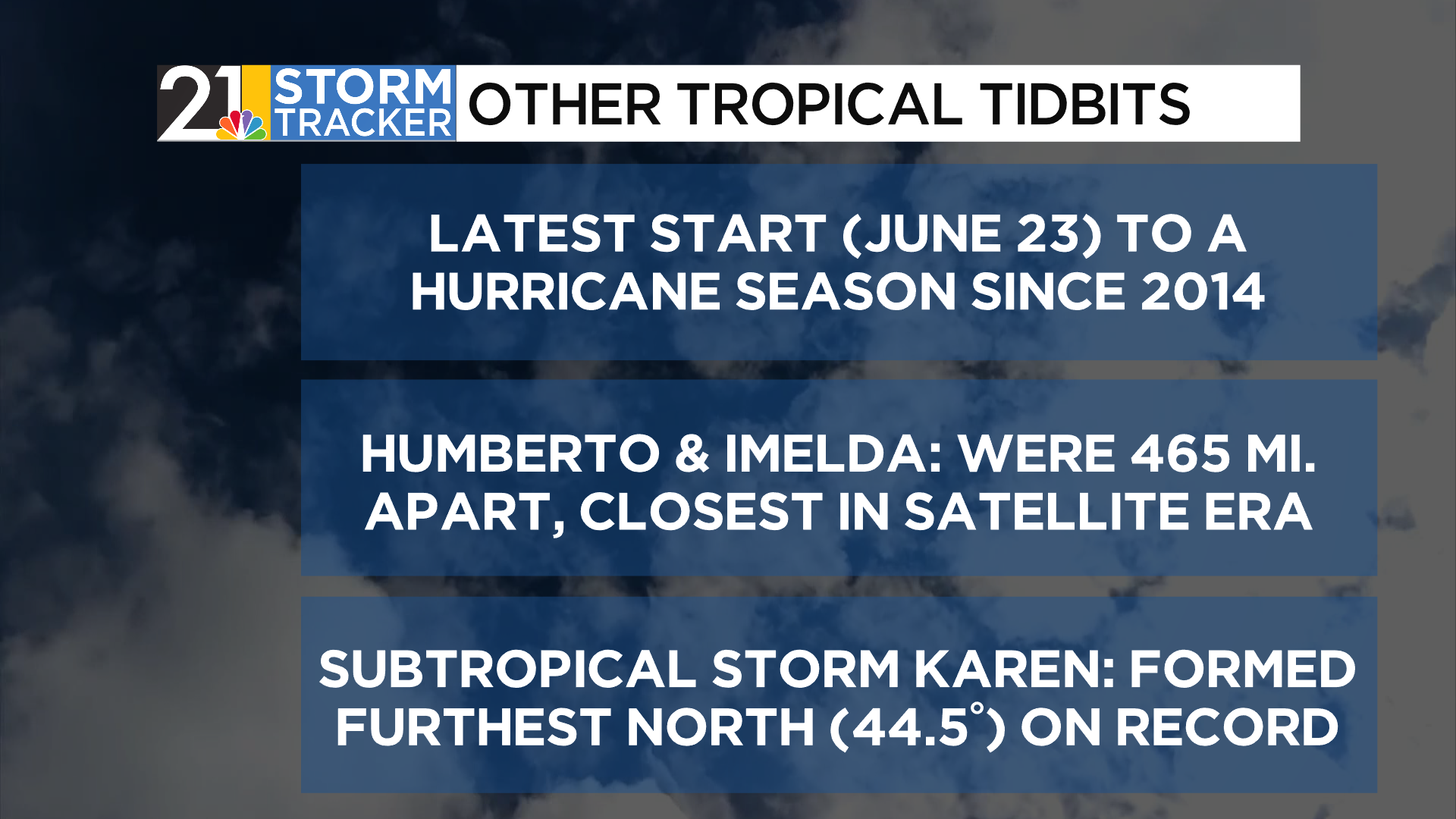
Some interesting bits of activity can also be placed in the record books. Andrea’s formation in late June was the latest start to a tropical season since 2014, when Hurricane Arthur formed as late as July 1st to eventually make landfall in North Carolina. The “twin” hurricanes of Humberto and Imelda, covered at length in a previous Weather 101 segment, ended up being just under 500 miles apart from one another at one point, breaking records since at least 1960. Their “atmospheric dance” in the Fujiwhara effect was the first documented case of this in the Atlantic since 2016.
Additionally, some systems formed in odd places. Karen, which formed as a rather unknown subtropical storm last week, formed at roughly the same latitude (44.5 degrees North) as the state of Maine. This is the furthest North an Atlantic cyclone has ever formed, with reliable records dating to 1851.
Though the weather in our neck of the woods has significantly cooled off, it takes longer for ocean water to do the same. For this reason, there's about 15% more hurricane season activity after today's date. For the next seven days, though, the National Hurricane Center has not noted any specific areas they are watching for development.