Weather 101: When does the Valley tend to see its first flakes?
Love it or hate it, a four-letter word that starts with “s” will eventually make its way into our area in the coming months.
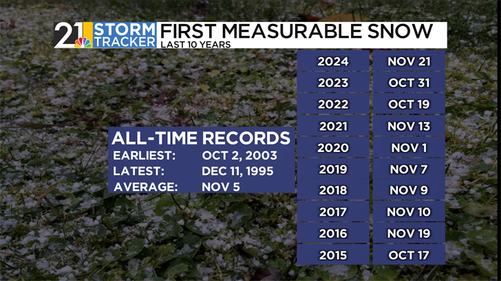
It’s snow! The Valley is entering the time of the year when it first falls. Climatologically speaking, the average first snowfall at the Youngstown-Warren regional airport occurs on November 5th. This date can vary depending on where you live, with those south of I-80 needing to wait a little longer, on average, and those even closer to the Erie Lakeshore can typically see flakes even sooner. In the past ten years, the airport has seen accumulating snow starting anytime between mid-October and mid-November. 22 years ago, the Valley saw its earliest snowfall on October 2nd, while the winter of 1995 got to a late start, with folks not seeing snow until December 11th, over a month behind schedule.
How does our area end up getting snow in the first place? In winter, two main weather patterns are responsible for bringing flakes to the region.
Lake-effect snow tends to leave its biggest impact on communities in Trumbull and Mercer Counties. Cold winds blowing over a still-warm lake can cause enough instability to create precipitation.
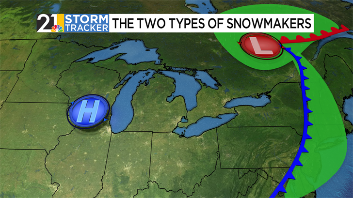
Strong rainstorms can also cause lake-effect snow. Remember that rain usually comes from low-pressure systems, which include both warm and cold fronts. Cold fronts, typically bringing the heaviest rain, are the divide between warm, humid air and cold, dry air. If the difference in air masses is great enough, a pattern favorable in winter, winds from a high-pressure system off to the west can howl.
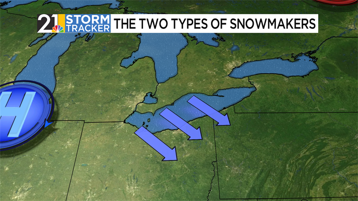
While wind itself matters greatly, the direction of this wind is even more important for lake-effect snow. Winds from the Northwest tend to maximize the distance where the cool, wintry air mixes with the warm, moist lake air from below. If the temperature difference between heights, or lapse rate, is large enough, it allows for lake effect snow to form.
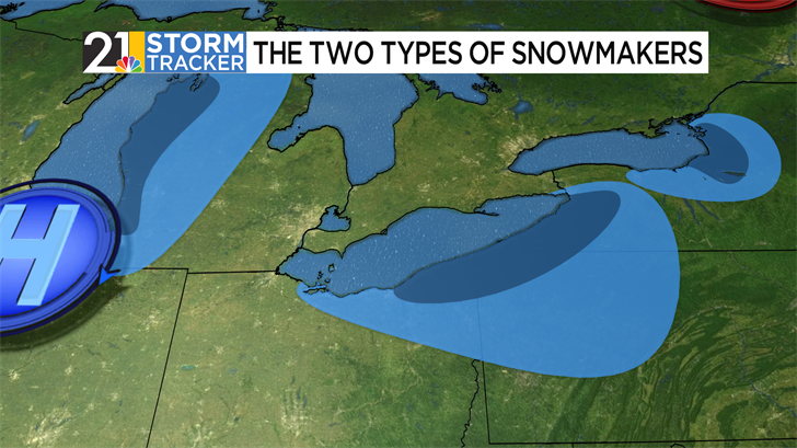
This is a very common snowmaker in early winter, especially if the area lake is warm enough for a sustained stretch in the season. Lake, Geauga, Ashtabula, Erie, and Crawford counties are all considered to be in the “primary” snowbelt, where lake-effect snow most commonly occurs. However, lake-effect snow can bring small-scale impacts to all of our area.
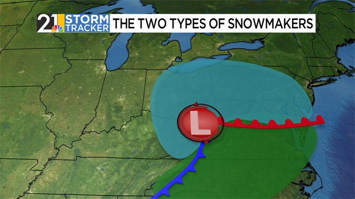
Coast-to-coast winter storms can also bring wintry impacts to Ohio and Pennsylvania. They don’t commonly occur as early, though, because much colder air is needed over a widespread area. In these cases, low-pressure areas skirt to our south- leaving our area out of the “warm sector” between the low’s warm and cold fronts. In this case, light-to-moderate snow typically falls all over our area.
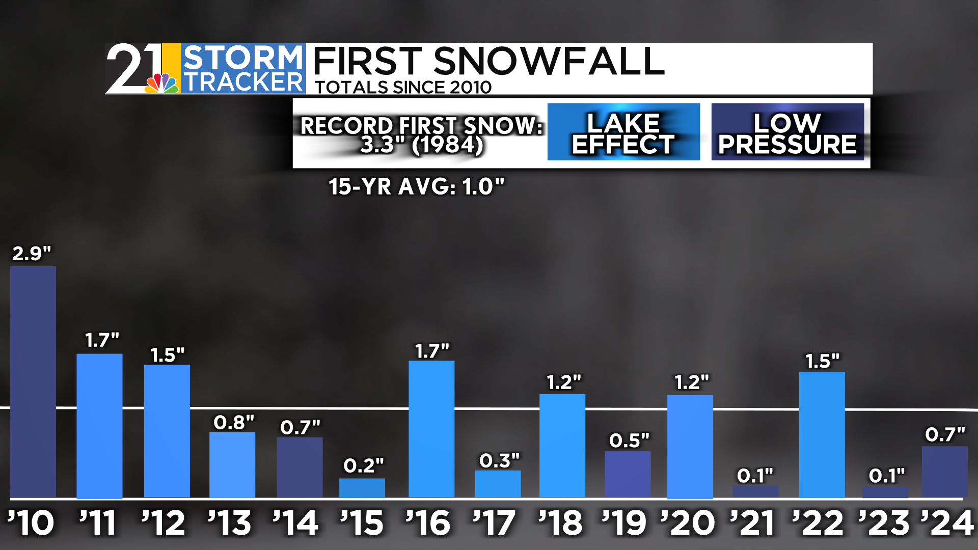
For this reason, lake-effect snow is the dominant way the airport receives its first measurable accumulation. In ten of the last fifteen years, this is exactly the method. This happened in three years between 2011-13, and a four-year run between 2015-18. Other years, such as 2023 and 2024, featured a rain-to-snow changeover thanks to a low-pressure system bringing inclement weather. In 2019, both of these methods were seen on the same day. Between these two snow-bringers, though, it is common to have very minor snow totals. In the last fifteen years, the date of the first snowfall averages just around an inch, and there hasn’t been a winter kickoff that has seen greater than 3.3 inches. That happened in 1984.
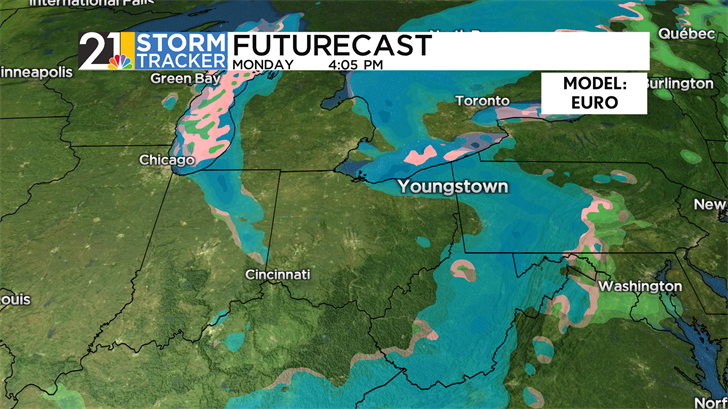
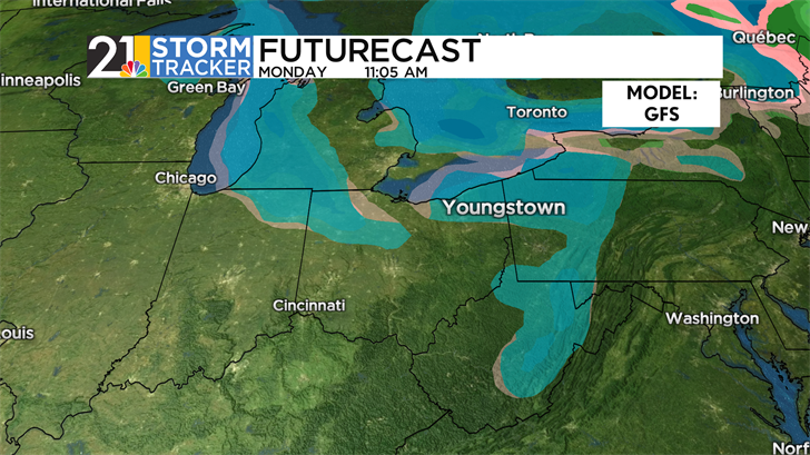
Our area is expecting gloomy conditions throughout the weekend, as a low-pressure system brings scattered rain showers and rather blustery conditions. After a cold front moves through on Sunday, winds will be favorable for the first lake-effect snow event to kick off the week. While snow totals at this point are still too early to call, expect the Valley to get its first flakes, just a few days behind schedule.