
Weather 101: Fetch
Whether you like it or not, Old Man Winter has made a quick stop in the Valley.
The area’s first widespread lake-effect snow will impact folks for most of Monday and into Tuesday.
While lake-effect snow could not be possible without high lapse rates between a warm lake and cold air aloft, prevailing winds are arguably as important to set up an impactful event.
Like a car that needs a full tank of gas to run efficiently, lake-effect snow needs plenty of “fuel” to get going. That fuel comes from the warm, moist air rising off the lake and mixing with the cold, dry air above. When this mixing continues long enough, the process powers up and produces heavy snow- just as a car runs best when it has enough fuel to keep the engine going.
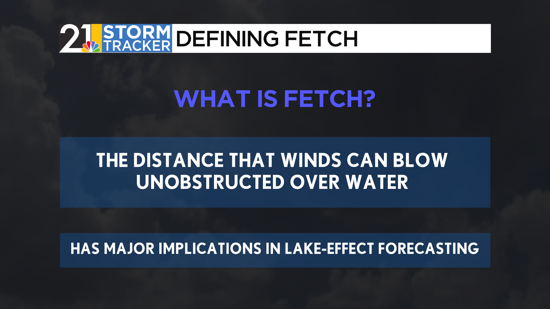
This is why fetch, or the distance that winds blow unobstructed over water, is another important variable to know in lake-effect forecasting. In simpler terms, fetch describes how long the wind will go from coast to coast on a lake.
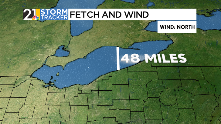
Consider today’s setup, with winds blowing from the North. If this wind were to go coast-to-coast into our area, its fetch over Lake Erie would be just shy of 50 miles. While rather far, this is not the furthest it can go.
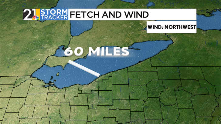
As high pressure moves closer to our area, winds will turn from the North to a more Northwesterly direction. Instead of splitting the lake vertically, the wind is now cutting into it at an angle, allowing for the fetch to be closer to 60 miles. Think of these ten extra miles as ten more gallons of fuel that can be put in a car, allowing the lake-effect to run more efficiently than a northerly wind.
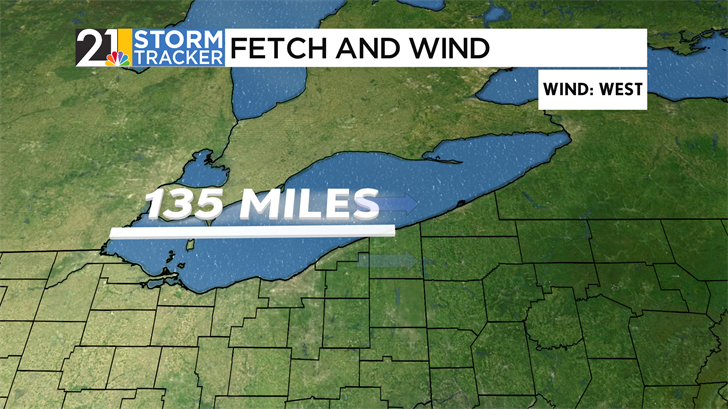
Because Lake Erie covers more East-West distance than North-South ground, winds from the west allow the most mixing of these two different air masses. Winds hitting the coast of Ashtabula County cover roughly 135 miles on the lake- as far west as Toledo- and more than double the fetch of a northwesterly wind.
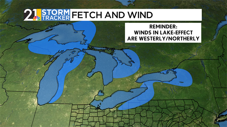
Generally, the greater the fetch, the more impactful these lake-effect systems will be. For this reason, winds between 250° and 10° (Roughly West-Southwesterly to Northerly) are the best for high-impact lake-effect bands to set up. Lake Erie specifically can see this happen between any of these wind directions, though the most impactful bands set up when the wind is West-Southwesterly, maximizing the amount of fetch on Lake Erie. In this case, winds can persist over the lake for almost 250 miles, putting cities such as Buffalo, NY, in the bullseye for feet of continuous, high-impact snow.
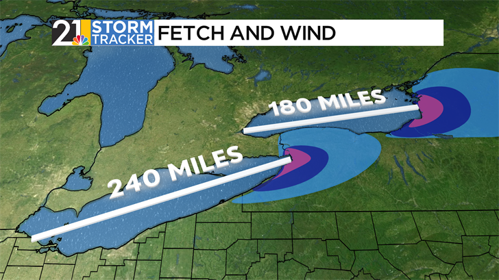
The same scenario exists on Lake Ontario, as the lake’s alignment is roughly the same as that of Erie. Winds blowing just south of West can have a fetch of 180 miles, giving towns like Syracuse, Oswego, and Watertown, NY, very impactful events when the wind sets up just right.
