
A midwinter thaw is in sight
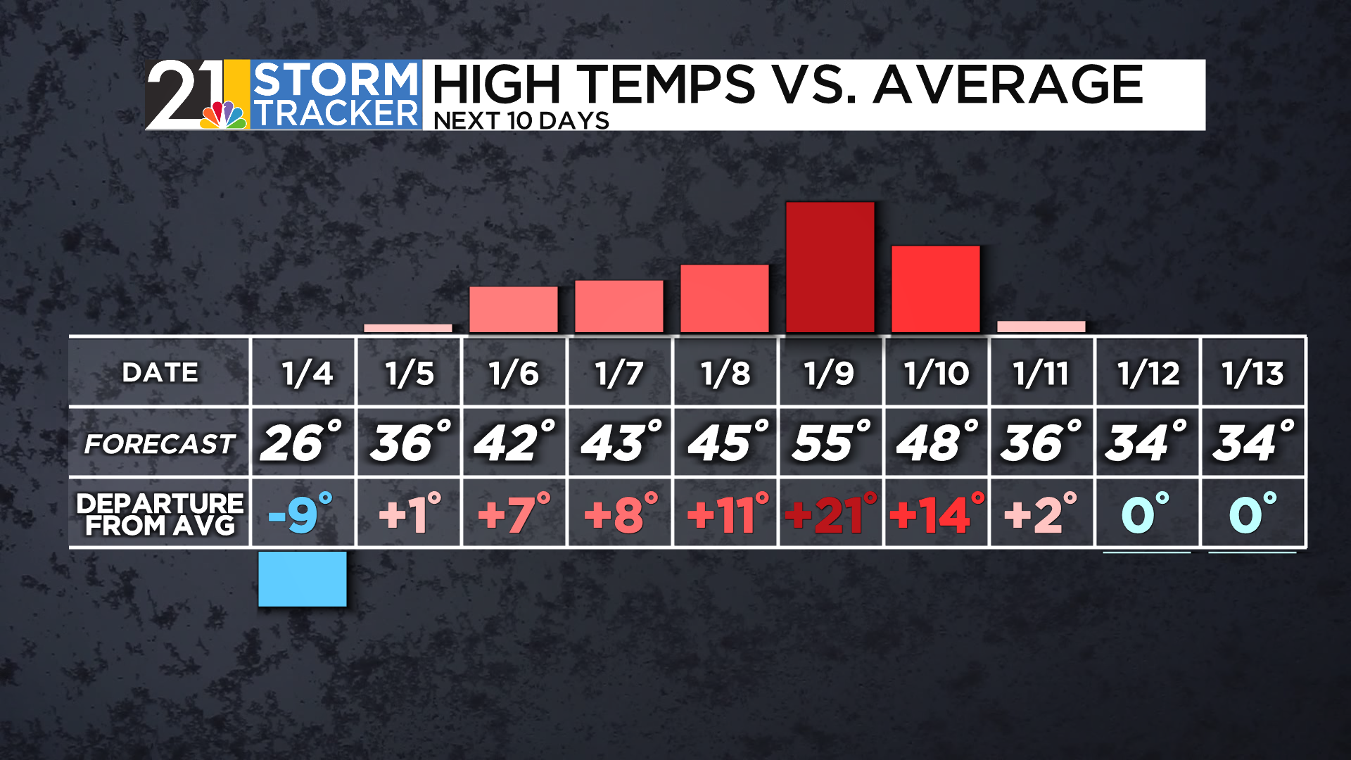
The first weekend of 2026 got underway with cold but uneventful weather Saturday, and Sunday is likely to follow suit. While some places might pick up a fresh coating of snow overnight, the daylight hours on Sunday should be tranquil under an overcast sky. Much like Saturday, temperatures will stay below freezing all day.
It's been a cold start to the new year, but a pattern change is looking increasingly likely as many head back to work and school. Monday morning's temperatures will be in the 20s, but some sun should help boost readings into the 30s during the afternoon. Tuesday and Wednesday look even milder, although with some raindrops in the forecast.....especially Tuesday afternoon and evening.
A strong area of low pressure is set to cruise through the Great Lakes region during the second half of the week, resulting in more rain chances by Thursday night and Friday. The system wll draw unseasonably mild air northward and we expect highs to be in the 50s for at least one day. Colder and more seasonable air is likely to return as next weekend wears on.

