
Still mild Saturday, but January roars back on Sunday
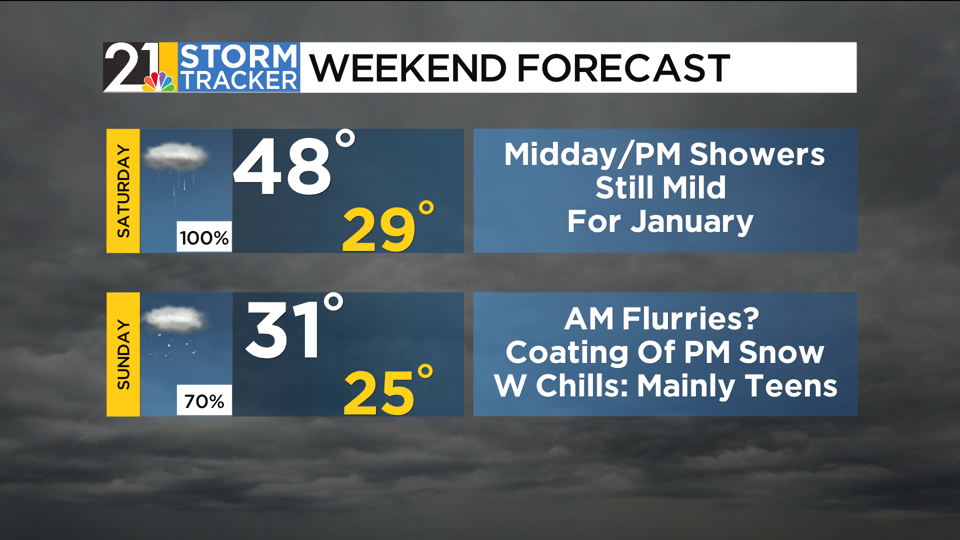
An April-like day unfolded on Friday with afternoon temperatures in the 60s throughout eastern Ohio and western Pennsylvania. While Saturday's numbers will not be as lofty, it will still be quite mild for this time of the year with highs mostly in the 40s. Average highs during the first half of January are in the mid 30s. As low pressure moves across the region, rain showers will dampen a fair amount of the area from midday into the afternoon. Rain will taper off and end early in the evening.
Meanwhile, a potent cold front will charge through the Ohio Valley on Saturday, putting it on track to cross the WFMJ viewing area overnight. In the wake of the front, temperatures will drop a few degrees below freezing by daybreak Sunday; readings will hold nearly steady throughout the daylight hours. Wind chills should be mostly in the teens Sunday with gusty winds and plenty of afternoon clouds. While there can be some passing flurries in the morning, an uptick in snow showers during the second half of the day could result in a fresh coating of snow in some spots.
A quieter day is in the forecast for Monday with times of clouds and sun. While temperatures won't stray far from the seasonal average during the first half of the work week, arctic air is set to return before the week is through.

