A bitterly cold forecast; flirting with record lows by Friday morning

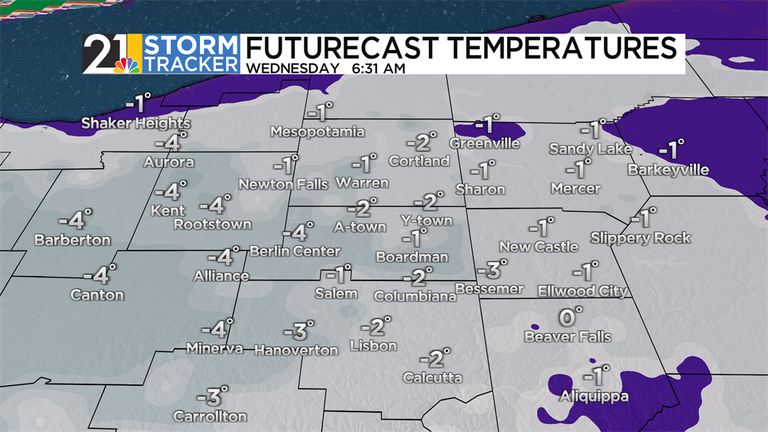
Temperatures will plunge below zero in most of the area overnight and into early Wednesday morning, and while wind chills will probably not be as low as Tuesday's morning's values, it will still feel like 10 or even 15 below by daybreak. We expect clouds to win the battle during the midday and afternoon hours Wednesday with highs only in the lower teens.
A few snow flurries will be a possibility Wednesday night and during the second half of Thursday, but we are not expecting much snow during the rest of January. After a fairly cloudy Thursday, the sky will clear some Thursday night. Relatively light winds over the fresh, deep snowpack will be a recipe for a very cold night and a record low will be given a challenge. The lowest temperature on record for Friday's date is -8, set in 1965.
Saturday's low temperature could also be within shouting distance of a record. The upcoming weekend looks cold but quiet with a good deal of anemic sunshine in the forecast for the first day of February Sunday. The first week of February will be cold, but not as frigid as the final week of January.