
Showers and storms back in today's forecast
@emilyfrazzwfmj Thursday Forecast- SEVERE WEATHER THREAT low end risk. Showers are expected later this afternoon. Hail and high winds are possible along with some rumbles of thunder. Stay weather aware this afternoon and download the Storm Tracker 21 app! pic.twitter.com/r3JB4XN3cT — StormTracker 21 (@StormTracker21) August 15, 2019 Today’s forecast is looking a little more damp in comparison to our Wednesday forecast. We expect the first half of the day to remain qui...
@emilyfrazzwfmj Thursday Forecast- SEVERE WEATHER THREAT low end risk. Showers are expected later this afternoon. Hail and high winds are possible along with some rumbles of thunder. Stay weather aware this afternoon and download the Storm Tracker 21 app! pic.twitter.com/r3JB4XN3cT
— StormTracker 21 (@StormTracker21) August 15, 2019
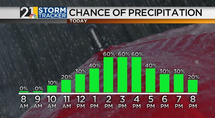
Today’s forecast is looking a little more damp in comparison to our Wednesday forecast. We expect the first half of the day to remain quiet with a mix of sun and clouds. Chances for showers and thunderstorms increase for the second half of the day. The viewing area is under a low-end risk for severe weather with high winds as the main threat. Today's high will be in the low 80s.
Friday’s forecast is looking a little bit better with a mix of sun and clouds with a continued high in the low 80s. A stray isolated shower can’t be completely ruled out during the afternoon.
Temperatures will continue to get warmer on Saturday with a high in the mid-80s and partly sunny skies.
Sunday and Monday are looking hot and humid with a high of 90 degrees!
Stay up to date on the latest forecast and download the Storm Tracker 21 app!


